Typical flood
Page Contents:
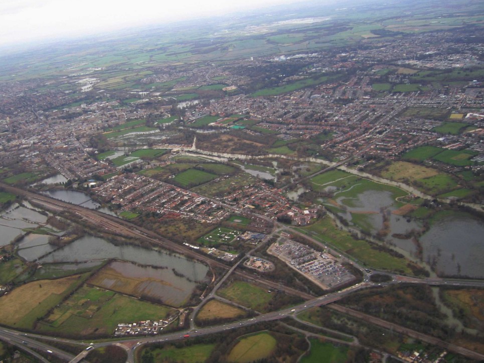
Flooding in South Oxford
The geography of Oxford, unfortunately, contributes to the flood risk, with a variety of rivers and streams pouring into a valley that narrows to the south of the city. The historical build-up of land and roads in this area doesn’t help.
The floodplain of the River Thames is underlain by very permeable sands and gravels, and the rivers in the area are very well connected to these. When the river levels rise, due to rainfall further upstream, it forces water into the sands and gravels. This causes the water table to rise resulting in groundwater flooding. Most of the roads and buildings in South Oxford were built above the natural ground level because the land was known to routinely flood directly from the river. Although this high ground can mostly keep the river flood water at bay it doesn’t stop the water table from rising. The rising water table can affect houses that have converted their cellars into living areas as well as the few houses that have their ground floor down at natural ground level. It also floods many gardens and outhouses that are built closer to the original floodplain level. The flood waters can infiltrate the sewer system causing household drainage to work less effectively and impact the local electricity grid causing power outages.
This is not to say that direct river flooding isn’t an issue in South Oxford. During flood events water can overbank and cut off stretches of the Thames towpath. Flood water can make its way into gardens, houses and roads next to and further from the river. For example, during major floods, water flows from the Eastwick Ditch that runs along the north of Hinksey Park, across the tennis courts into Hinksey Lake which, before the flood barriers were available, would flow east down Lake Street and Vicarage Road. Water also overbanks from the Hinksey Stream and flows east along some of the roads in New Hinksey towards the Abingdon Road. Water also overbanks from Weirs Mill Stream, upstream of the weirs, west towards the Abingdon Road. The flooding that can sometimes close the Abingdon Road is a combination of these river flood waters and, it is thought, rising groundwaters. The groundwater may be the reason why it takes so long for the Abingdon Road to clear once the river levels have dropped.
Authorities are still trying to understand the complex relationship between river and groundwater flooding in the South Oxford area. The Oxford Flood Alleviation Scheme is designed to send more flow down the western floodplain to reduce river levels and, in turn, groundwater levels in South Oxford. The scheme is fully developed and has received planning permission. You can find out more about the Oxford Flood Alleviation Scheme here.
What is groundwater flooding?
Most people probably associate inland floods with water bursting over river banks (river flooding) or drains not being able to cope with sudden heavy spells of rain (surface water flooding). However, groundwater flooding (that is water rising up through the ground) is also a risk. South Oxford is prone to all these forms of flooding, but people know little about groundwater flooding.
Groundwater flooding happens when the level of water rises within the rock underground (the water table). During very wet periods the water table can rise into cellars and basements and into the sewers or sometimes even beyond the ground level causing fields, gardens and the ground floor of buildings to flood. In South Oxford, the rise in the water table is mainly due to the pressure of the very high river levels during flood events.
In the area, the peak of groundwater flooding tends to happen around a day after the peak in river flooding. Groundwater floods also take longer than river floods to disappear. Controlling groundwater poses a real difficulty – you can’t use the traditional flood defences used to keep rivers in bank, as the flood waters come up from beneath.